
Upper Hamble River
The wreck of the Grace Dieu, a 15th Century ship built for Henry V lies close to the jetty for River Hamble Country Park after being struck by lightning and catching fire in 1439. This, along with a number of other wrecks, historic shipbuilding sites and oyster beds have been mapped by the Marine Archaeology Trust as part of an extensive research project exploring the River Hamble.
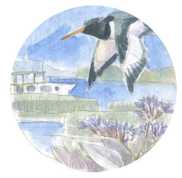
Also on the plaque there is an Oystercatcher and Common sea-lavender. Oystercatchers are black and white wading birds who mostly eat cockles, mussels and worms. Find out more about Oystercatchers on the RSPB website. Common sea-lavender grows along the coast and although it has purple-coloured flowers it is not actually related to lavender and is not fragrant. Read more about sea-lavender on the Wildlife Trust website.
This is the fourteenth marker post on the Hamble Peninsula Trails. From here it takes approximately 35 minutes to walk south along supporting trails to Bursledon Station.
The longer Principal Trail south to Hamble Foreshore takes an additional 65 minutes to walk.
Taking that Principal Trail south and then west to Netley Abbey takes around 2.5hrs to walk; or a shorter cross-country walking route using the supporting trails is about 60 minutes.
You can also use the supporting trails to find your own route either along the coast, or inland visiting Netley, Hamble and Bursledon railway stations, where you will find the Parish Posts designed by artist Madeleine Allison.
Upper Hamble River